

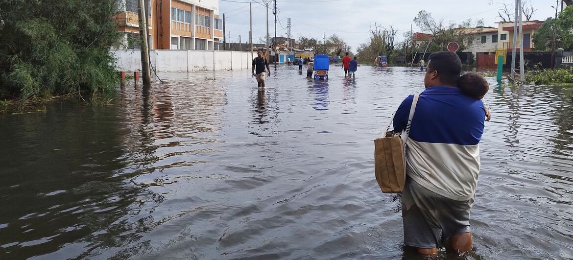
A sophisticated satellite-based analysis released today by the United Nations Development Programme (UNDP) has laid bare the devastating impact of twin cyclones that ravaged Madagascar in early February. The report confirms that the back-to-back storms struck with the greatest severity in regions where communities were already struggling to secure basic necessities, pushing thousands to a precarious breaking point.
The west coast was first besieged by Cyclone Fytia between 31 January and 1 February. Scarcely ten days later, on 10 February, Cyclone Gezani made landfall near Toamasina on the eastern seaboard. The successive deluges triggered widespread flooding, obliterating homes, critical infrastructure, and the farmlands upon which the vast majority of the population depends.
The UNDP’s geospatial assessment provides a harrowing look at the scale of the disaster. Floodwaters inundated areas inhabited by approximately 350,000 people. Crucially, the data reveals that 63 per cent of those affected were already living in conditions of extreme vulnerability, lacking reliable access to essential services and adequate housing before the first storm even arrived.
By integrating satellite imagery with socioeconomic data, the UNDP has been able to map the precise “overlap” of flood damage and pre-existing poverty. This high-resolution approach is designed to guide humanitarian and recovery efforts to the areas where support is most urgently required.
“For families who were already living day to day, these floods are a breaking point,” observed Dr Edward A. Christow, the UNDP Resident Representative in Madagascar. “We can see clearly where homes, crops, and incomes have been washed away in communities that had the least to begin with. Acting quickly in these hardest-hit areas is critical to help people rebuild their livelihoods and regain stability.”
The impact on the agricultural sector has been catastrophic. In a nation where nearly eighty per cent of households rely on farming for both sustenance and income, the loss of up to 174,100 hectares of cropland to floodwaters poses an existential threat. In several eastern communes, more than 80 per cent of crops were affected, sparking fears of a localized food crisis.
Local residents are already feeling the strain. Mrs Lala, a mother of six in Antetezambaro, expressed the growing anxiety shared by many: “The crops are damaged and yields will be low. We are truly afraid of famine this year. We still have some of last year’s harvest to sell, but once those reserves are depleted, we will be in dire straits.”
The disruption extends beyond the fields. Small business owners, such as Volamanana Clarisse, who sells milk to support her family, have seen their livelihoods vanish overnight. “Without electricity, I cannot run my refrigerator to store the milk,” she explained. “Before the cyclone, I sold up to 150 litres of milk a day. Now, I only sell 20 litres.”
The UNDP is currently collaborating with national and local authorities to formulate a comprehensive recovery plan. The priority remains the restoration of irrigation systems, the clearance of debris, and the repair of transport networks to reconnect markets.
Experts warn that without swift intervention to support small-scale farmers and local enterprises, the current crisis may lead to prolonged displacement and chronic food insecurity. The UNDP’s strategy focuses on “field verification” matching satellite data with real-world needs to ensure that assistance is delivered with dignity and precision to those who have lost the most.


Leave a comment