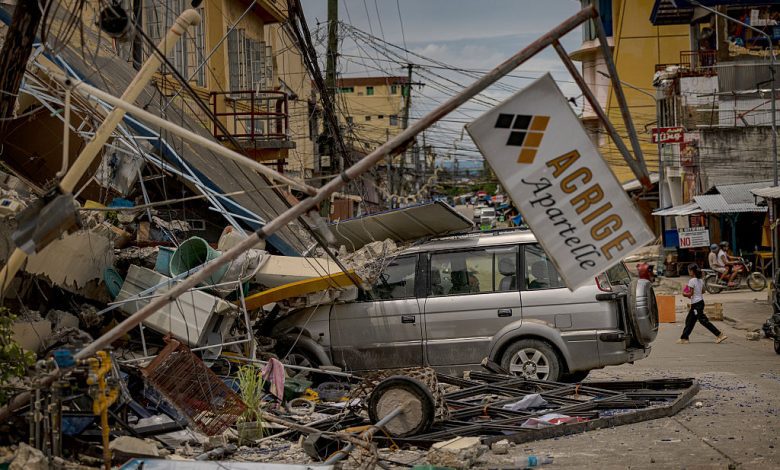
Officials have now lifted a tsunami warning, triggered by the 7.4 magnitude earthquake in the Philippines. The quake took place overnight according to clocks in North America (01:44 UTC on October 10, or 9:44 a.m. in the Philippines this morning). It had prompted evacuations of coastal areas, as tsunami warnings were issued for seven of the Philippines’ 82 provinces, plus parts of Indonesia. The Guardian reported that people fled “in panic.” But only minor tsunami waves were observed. Several media are now reporting that the death rate was low from the quake, with just five known deaths so far. But buildings are damaged, and power is still out in some places.
Meanwhile, seismic instruments recorded hundreds of aftershocks. The aftershocks are still happening at this writing. You can follow them on the U.S. Geological Survey’s Latest Earthquakes page.
The October 10 earthquake followed a 6.9 earthquake in Cebu, a province in the Philippines, which occurred just 11 days earlier. Reuters reported a week ago that that earlier earthquake was the deadliest in over a decade, with 69 dead, and that officials were still hunting for survivors.
Effects of the 7.4-magnitude earthquake
The Guardian reported that, after the October 10 earthquake:
… Schools were shuttered and several buildings sustained cracks, including the international airport building in Davao. However, the airport remained operational with no flights cancelled.
Neighboring Indonesia also issued a tsunami warning for the areas of north Sulawesi and Papua, with reports only of small waves in those regions.
President Ferdinand Marcos Jr., facing his latest natural disaster after a previous earthquake and back-to-back storms, said his team was assessing potential damage. He said rescue teams and relief operations were being prepared and would be deployed when it was safe to do so.
Details of the 7.4-magnitude earthquake
The Philippine Institute of Volcanology and Seismology said it was expecting damage and aftershocks from the earthquake. The quake was centered at sea about 43 kilometers (27 miles) east of Manay, in Davao Oriental province, and was caused by movement in the Philippine Trench at a depth of 23 kilometers (14 miles).
The U.S. Geological Survey (USGS) has published the following summary:
The October 10, 2025, M 7.4 earthquake off the east coast of the island of Mindanao, Philippines occurred as a result of oblique reverse faulting … At the location of the earthquake, the Philippine Sea plate subducts west-northwest with respect to the Sunda plate at a velocity of approximately 100 mm/yr.
While commonly plotted as points on maps, earthquakes the size of the October 10, 2025, event are more appropriately described as slip over a larger fault area. Earthquakes of this magnitude are typically about 75×30 km (length x width).
As is common with most subduction zone plate boundaries, the Philippines frequently experiences moderate-to-large earthquakes. One hundred fifty-five other earthquakes of M6 or larger have occurred over the past century within 250 km of October 10, 2025, earthquake, including 15 other M7+ earthquakes.
Bottom line: A 7.4-magnitude earthquake offshore in the Philippines prompted a tsunami warming, causing coastal residents to flee, but observers reported only small waves. The quake left only 2 known dead so far.
Source: earthsky.com


